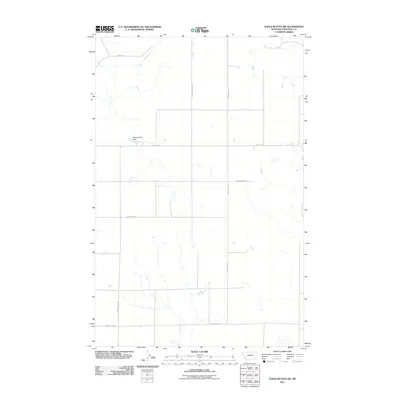
2011 Map of Eagle Buttes SW
USGS Topo · Published 2011About this map
Nickles Worth Dam stands as a primary water management feature in this sparsely populated region of Chouteau County, where the landscape is defined by its agricultural and ranching utility. A systematic grid of local roads and trails provides the infrastructure for this rural expanse, including Citadel Trl and Roudebush Ln, which cross the terrain alongside several north-south routes like Pump Station Rd and Hard Rock Rd. The map reveals the practical organization of the northern plains in the early 21st century, where even minor drainage features like Dorn Coulee Rd necessitate specific naming for navigation and land management. The presence of routes such as Graceville Rd N and Tadej Ln suggests the enduring layout of family-named roads and rural access points that have anchored the community for generations.
Find a feature on this map
9 named features on this map. Tap any name to fly to it.
Don’t see what you’re looking for? This feature index may not catch every label — zoom into the map to look around manually.
Map Details
Editions of this 2011 Eagle Buttes SW Map
This is the sole edition of this map. No revisions or reprints were ever made.
Other maps of this area

1890 · Fort Benton
USGS Topo · 1:250,000

1892 · Fort Benton
USGS Topo · 1:250,000

1897 · Fort Benton
USGS Topo · 1:250,000

1953 · Eagle Buttes
USGS Topo · 1:24,000

1953 · Big Bend School
USGS Topo · 1:24,000

1953 · Pilot Rock
USGS Topo · 1:24,000

1953 · Stranahan
USGS Topo · 1:24,000

1954 · Great Falls
USGS Topo · 1:250,000

1957 · Great Falls
USGS Topo · 1:250,000
1972 · Eagle Buttes SW
USGS Topo · 1:24,000