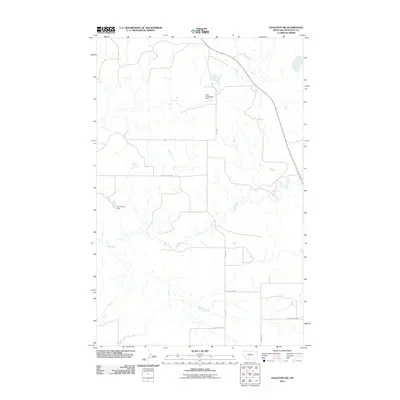
2011 Map of Eagleton NW
USGS Topo · Published 2011About this map
Eagle Creek meanders through this section of Chouteau County, where the high plains landscape is defined by a network of ranch roads and small-scale water management projects. The map depicts a rural environment centered on agricultural infrastructure, notably the Baba Blacksheep Dam and the Otto Silvan Dam. These features, along with the numerous seasonal drainages feeding into the creek, underscore the vital importance of water capture in this arid Montana region. The road network follows a sparse but functional grid, with routes such as Sheep Coulee Rd and Eagle Butte Rd providing access to the vast open acreage. The inclusion of labels like Five Corner Rd and Hopp Rd helps researchers orient themselves within the local geography of the early 21st century.
Find a feature on this map
9 named features on this map. Tap any name to fly to it.
Don’t see what you’re looking for? This feature index may not catch every label — zoom into the map to look around manually.
Map Details
Editions of this 2011 Eagleton NW Map
This is the sole edition of this map. No revisions or reprints were ever made.
Other maps of this area

1890 · Fort Benton
USGS Topo · 1:250,000

1892 · Fort Benton
USGS Topo · 1:250,000

1897 · Fort Benton
USGS Topo · 1:250,000

1919 · Big Sandy
USGS Topo · 1:125,000

1953 · Eagle Buttes
USGS Topo · 1:24,000

1953 · Lonetree Coulee
USGS Topo · 1:24,000

1953 · Pilot Rock
USGS Topo · 1:24,000

1953 · Havre
USGS Topo · 1:250,000

1954 · Great Falls
USGS Topo · 1:250,000

1954 · Iliad
USGS Topo · 1:24,000