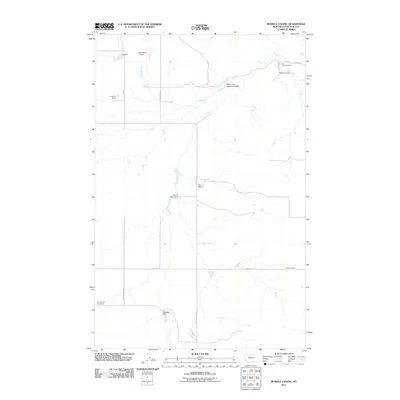
2011 Map of Russell Chapel
USGS Topo · Published 2011About this map
Russell Chapel serves as a central landmark in this portion of Chouteau County, where the high plains are carved by drainages like the North Fork Dugout Coulee. The landscape is defined by its agricultural utility, featuring a series of family-named ranching operations including the Bar Z F Ranch, Witt Ranch, and Stewart Ranch. Water management is critical in this dry terrain, evidenced by numerous small-scale reservoirs such as Dog Star Dam, Smart Mans Dam, and the curiously named Dolabriform Dam. Local roads, including Beaverslide Rd and Brady Rd E, provide the primary grid connecting these isolated outposts. Genealogy researchers will find the Sample Flat Cemetery on the western edge of the quadrangle, a significant point of interest for tracing the early settlers of these Montana ranch lands.
Find a feature on this map
19 named features on this map. Tap any name to fly to it.
Don’t see what you’re looking for? This feature index may not catch every label — zoom into the map to look around manually.
Map Details
Editions of this 2011 Russell Chapel Map
This is the sole edition of this map. No revisions or reprints were ever made.
Other maps of this area

1886 · Great Falls
USGS Topo · 1:250,000

1890 · Fort Benton
USGS Topo · 1:250,000

1892 · Fort Benton
USGS Topo · 1:250,000

1897 · Fort Benton
USGS Topo · 1:250,000

1950 · Dent Bridge
USGS Topo · 1:62,500

1954 · Great Falls
USGS Topo · 1:250,000

1954 · Shelby
USGS Topo · 1:250,000

1957 · Great Falls
USGS Topo · 1:250,000

1958 · Shelby
USGS Topo · 1:250,000

1970 · Carlson Coulee
USGS Topo · 1:24,000