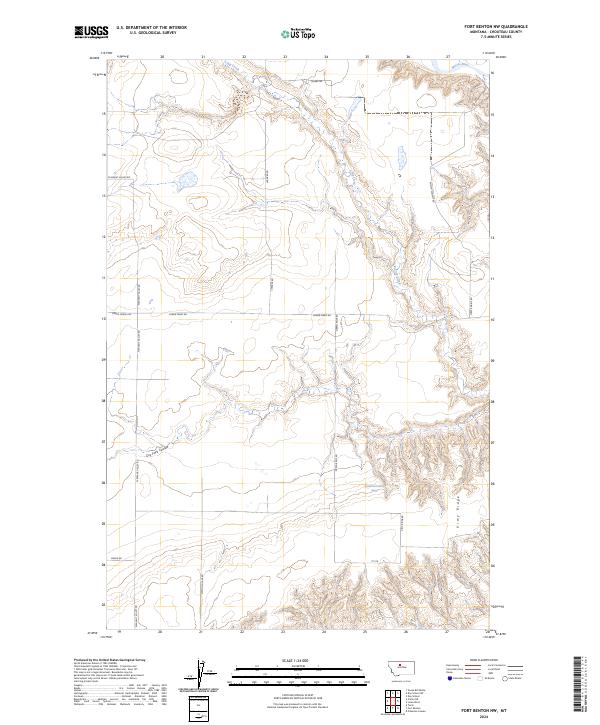
2024 Map of Fort Benton NW
USGS Topo · Published 2024About this map
The Marias River carves through the northern reaches of this High Plains landscape, defining the topography of Chouteau County as it flows toward the Missouri. The terrain is marked by a complex system of drainage coulees, most notably the Dry Fork Coulee and Chip Creek, which have etched deep contours into the surrounding plateau. A series of section-line and topographic roads, such as Pleasant Valley Rd and Diamond Lake Rd, reveal the grid-based land management common to Montana’s agricultural and ranching heartland. To the southeast, the elevated landform of Vimy Ridge provides a distinct geographic landmark overlooking the river valley. This 2024 survey documents the persistence of family-named routes like Emmett Wright Rd and Norby Rd, reflecting the generational footprint of rural homesteads in this part of the Big Sky state.
Find a feature on this map
20 named features on this map. Tap any name to fly to it.
Don’t see what you’re looking for? This feature index may not catch every label — zoom into the map to look around manually.
Map Details
Editions of this 2024 Fort Benton NW Map
This is the sole edition of this map. No revisions or reprints were ever made.
Other maps of this area

1890 · Fort Benton
USGS Topo · 1:250,000

1892 · Fort Benton
USGS Topo · 1:250,000

1897 · Fort Benton
USGS Topo · 1:250,000

1953 · Tunis
USGS Topo · 1:24,000

1953 · O'Hanlon Coulee
USGS Topo · 1:24,000

1953 · Loma West
USGS Topo · 1:24,000

1954 · Great Falls
USGS Topo · 1:250,000

1954 · Fort Benton
USGS Topo · 1:24,000

1954 · Shelby
USGS Topo · 1:250,000

1957 · Great Falls
USGS Topo · 1:250,000