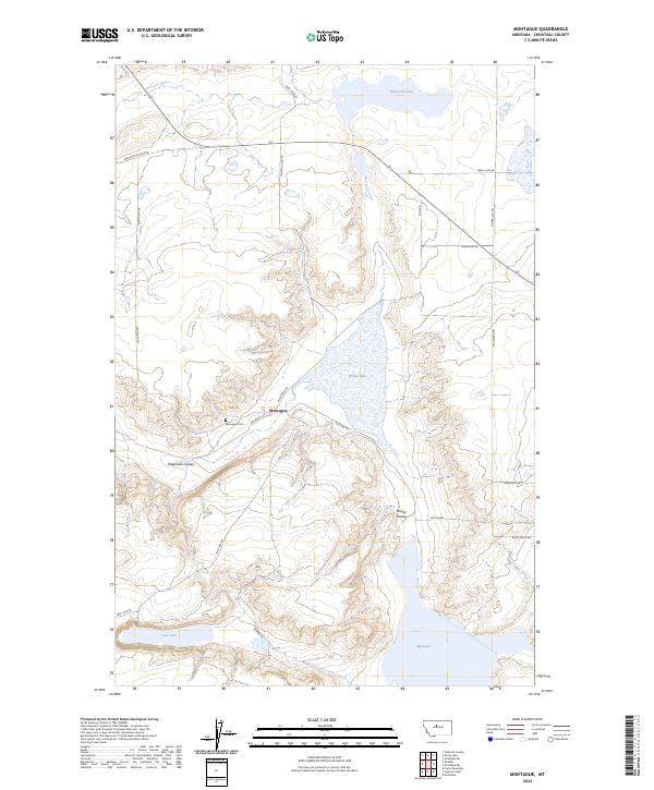
2024 Map of Montague
USGS Topo · Published 2024About this map
Montague serves as the central hub of this Chouteau County landscape, where the local community is anchored by Montague Cem and a street network including Railroad Ave. The geography is defined by a series of significant basins and drainage features, most notably the expansive Big Lake in the southeast and White Lake further north. These water bodies, along with Harwood Lake and Lost Lake, suggest a terminal drainage pattern typical of the high plains, where water collects in shallow depressions rather than flowing to distant rivers.
Find a feature on this map
27 named features on this map. Tap any name to fly to it.
Don’t see what you’re looking for? This feature index may not catch every label — zoom into the map to look around manually.
Map Details
Editions of this 2024 Montague Map
This is the sole edition of this map. No revisions or reprints were ever made.
Other maps of this area

1890 · Fort Benton
USGS Topo · 1:250,000

1892 · Fort Benton
USGS Topo · 1:250,000

1897 · Fort Benton
USGS Topo · 1:250,000

1953 · Rocky Lake
USGS Topo · 1:24,000

1953 · O'Hanlon Coulee
USGS Topo · 1:24,000

1954 · Great Falls
USGS Topo · 1:250,000

1957 · Great Falls
USGS Topo · 1:250,000
1972 · Stranahan SE
USGS Topo · 1:24,000
1972 · Montague
USGS Topo · 1:24,000
1972 · Shonkin
USGS Topo · 1:24,000