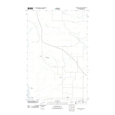
2011 Map of Lonetree Coulee
USGS Topo · Published 2011About this map
Little Sandy Creek and Big Sandy Creek thread through this northern Chouteau County landscape, illustrating the intricate water management required for high-plains agriculture in the early 21st century. The terrain is defined by its dramatic erosion patterns, notably Alkali Coulee and Lonetree Coulee, which descend toward a small segment of the Missouri River visible at the southwestern edge. The map captures a transition in rural land use where traditional drainage is augmented by several man-made structures. Water security is highlighted by features such as Osterized Dam, Dodecanese Dam, and the specifically named MacDonalds Farm Reservoir Dam. A grid of local roads, including Warrick Rd and Mountain View Rd, provides the primary infrastructure connecting these remote ranching and farming operations.
Find a feature on this map
17 named features on this map. Tap any name to fly to it.
Don’t see what you’re looking for? This feature index may not catch every label — zoom into the map to look around manually.
Map Details
Editions of this 2011 Lonetree Coulee Map
This is the sole edition of this map. No revisions or reprints were ever made.
Other maps of this area

1890 · Fort Benton
USGS Topo · 1:250,000

1892 · Fort Benton
USGS Topo · 1:250,000

1897 · Fort Benton
USGS Topo · 1:250,000

1919 · Big Sandy
USGS Topo · 1:125,000

1953 · Verona
USGS Topo · 1:24,000

1953 · Big Bend School
USGS Topo · 1:24,000

1953 · Lonetree Coulee
USGS Topo · 1:24,000

1953 · Pilot Rock
USGS Topo · 1:24,000

1953 · Havre
USGS Topo · 1:250,000

1954 · Great Falls
USGS Topo · 1:250,000