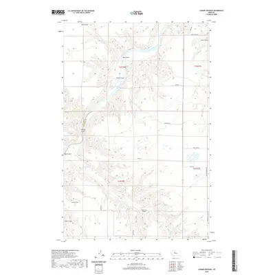
2020 Map of Lander Crossing
USGS Topo · Published 2020About this map
The Missouri River carves a deep, winding path through the northern plains of Central Montana, defining the border between Cascade and Chouteau counties. This landscape is characterized by its dramatic drainage patterns, where numerous deeply incised dry ravines or "coulees"—including Black Coulee, Huntley Coulee, and Tueverson Coulee—feed into the river and Highwood Creek. The settlement of Lander Crossing serves as a focal point for the region's transport network, which is linked by rural routes such as Ferry Rd and Lander Xing. The map illustrates a high-plateau environment where agricultural land is segmented by these sharp geographic breaks, revealing the challenges of traversing the terrain away from the established river crossings. Local landmarks like Widow Coulee and Ryan Coulee offer specific points of interest for those studying the early naming and ranching history of these northern counties.
Find a feature on this map
26 named features on this map. Tap any name to fly to it.
Don’t see what you’re looking for? This feature index may not catch every label — zoom into the map to look around manually.
Map Details
Editions of this 2020 Lander Crossing Map
This is the sole edition of this map. No revisions or reprints were ever made.
Other maps of this area

1886 · Great Falls
USGS Topo · 1:250,000

1890 · Fort Benton
USGS Topo · 1:250,000

1892 · Fort Benton
USGS Topo · 1:250,000

1897 · Fort Benton
USGS Topo · 1:250,000

1948 · Portage
USGS Topo · 1:62,500

1949 · Portage
USGS Topo · 1:62,500

1950 · Dent Bridge
USGS Topo · 1:62,500

1953 · Carter
USGS Topo · 1:24,000

1953 · Tunis
USGS Topo · 1:24,000

1954 · Great Falls
USGS Topo · 1:250,000