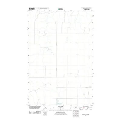
2011 Map of Stranahan SE
USGS Topo · Published 2011About this map
Clear Lake and its surrounding agricultural plains define this section of Chouteau County in the early 21st century. The landscape is organized by a precise grid of local routes, including Elim Rd, Enterprise Rd, and Geraldine Rd N, reflecting the enduring township-and-range surveying system of the American West. This map serves as a vital record for family researchers, as it clearly identifies the Clear Lake Cemetery located east of the lake itself. The drainage patterns and small basins surrounding Clear Lake Rd and Danbrook Rd illustrate the subtle topography of the Montana high plains, where water management and road placement are inextricably linked to the rural economy.
Find a feature on this map
11 named features on this map. Tap any name to fly to it.
Don’t see what you’re looking for? This feature index may not catch every label — zoom into the map to look around manually.
Map Details
Editions of this 2011 Stranahan SE Map
This is the sole edition of this map. No revisions or reprints were ever made.
Other maps of this area

1890 · Fort Benton
USGS Topo · 1:250,000

1892 · Fort Benton
USGS Topo · 1:250,000

1897 · Fort Benton
USGS Topo · 1:250,000

1953 · Rocky Lake
USGS Topo · 1:24,000

1953 · Loma East
USGS Topo · 1:24,000

1953 · Big Bend School
USGS Topo · 1:24,000

1953 · Stranahan
USGS Topo · 1:24,000

1954 · Great Falls
USGS Topo · 1:250,000

1957 · Great Falls
USGS Topo · 1:250,000
1972 · Eagle Buttes SW
USGS Topo · 1:24,000