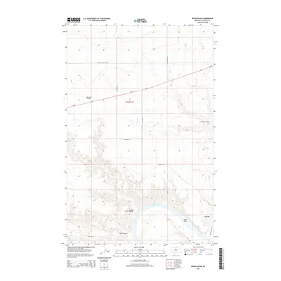
2014 Map of Boggs Island
USGS Topo · Published 2014About this map
Virgelle stands as a focal point near the southern edge of this Chouteau County landscape, situated where the high plains meet the intricate drainage systems of the upper Missouri River. The area is defined by a series of deep erosional features, including Coal Banks Coulee, Sixmile Coulee, and Dry Fork Coulee, which carve through the terrain toward the river valley. In the river itself, Boggs Island sits near the bend that defines the local waterway geography. The transportation network is a mix of high-speed transit and local access, with Us-87 cutting diagonally across the northern sections, while rural paths like Virgelle Ferry Rd N and Stranahan Rd suggest the continuing importance of river-access routes and traditional ranching boundaries. This 2014 survey illustrates the persistent rural character of north-central Montana, where the physical landforms of the Spring Coulee and larger river breaks dictate the placement of roads and small-scale settlements.
Find a feature on this map
17 named features on this map. Tap any name to fly to it.
Don’t see what you’re looking for? This feature index may not catch every label — zoom into the map to look around manually.
Map Details
Editions of this 2014 Boggs Island Map
This is the sole edition of this map. No revisions or reprints were ever made.
Other maps of this area

1890 · Fort Benton
USGS Topo · 1:250,000

1892 · Fort Benton
USGS Topo · 1:250,000

1897 · Fort Benton
USGS Topo · 1:250,000

1906 · Lonesome
USGS Topo · 1:62,500

1919 · Big Sandy
USGS Topo · 1:125,000

1953 · Boggs Island
USGS Topo · 1:24,000

1953 · Loma East
USGS Topo · 1:24,000

1953 · Verona
USGS Topo · 1:24,000

1953 · Big Bend School
USGS Topo · 1:24,000

1953 · Stranahan
USGS Topo · 1:24,000