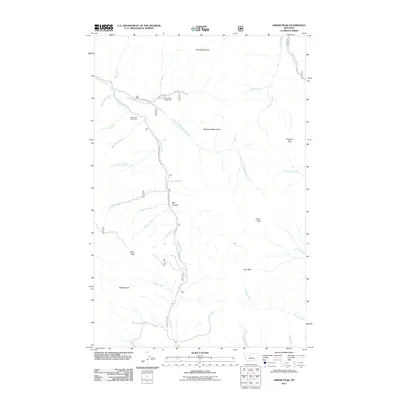
2011 Map of Arrow Peak
USGS Topo · Published 2011About this map
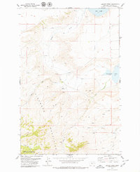
The Highwood Mountains dominate this central Montana landscape, where deep drainages and volcanic peaks define the terrain. High-altitude outposts such as Highwood Cow Camp and the Thain Creek Campground indicate a landscape shaped by seasonal ranching and recreation within the national forest. The hydrology is particularly complex, with the North Fork Highwood Creek carving through the northern half while the headwaters of Arrow Creek and Birch Creek drain the southern slopes. Notable summits like Arrow Peak, Lava Peak, and Prospect Peak provide significant landmarks for navigation and land management. The road network, including Shonkin Rd and County Rd 208, follows the natural contours of the coulees and creek beds, illustrating how transportation in this part of Chouteau County is dictated by the dramatic verticality of the mountain range.
Find a feature on this map
40 named features on this map. Tap any name to fly to it.
Don’t see what you’re looking for? This feature index may not catch every label — zoom into the map to look around manually.
Map Details
Editions of this 2011 Arrow Peak Map
This is the sole edition of this map. No revisions or reprints were ever made.
Other maps of this area

1890 · Fort Benton
USGS Topo · 1:250,000

1892 · Fort Benton
USGS Topo · 1:250,000

1897 · Fort Benton
USGS Topo · 1:250,000

1954 · Great Falls
USGS Topo · 1:250,000

1957 · Great Falls
USGS Topo · 1:250,000

1978 · Arrow Peak
USGS Topo · 1:24,000
1978 · Byrne Creek
USGS Topo · 1:24,000
1979 · Palisade Butte
USGS Topo · 1:24,000
1979 · Carter Mountain
USGS Topo · 1:24,000
1979 · Lepleys Creek
USGS Topo · 1:24,000