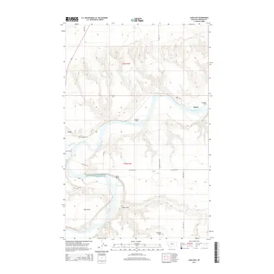
2014 Map of Loma East
USGS Topo · Published 2014About this map
The confluence of the Missouri River and the Marias River anchors this central Montana landscape, where the settlement of Loma sits near the historical site of Fort Piegan. The river's winding course creates dramatic features like Churchill Bend and Archers Island, while the current accelerates over the Black Bluff Rapids. This 2014 survey reveals a transition from these low-lying watercourses to elevated landforms like Rowe Bench and Black Bluffs, illustrating the classic river-cut topography of Chouteau County. Further downstream, the settlement of Lippard provides a focal point for the surrounding ranching and agricultural lands. Family-named landmarks such as Rowe Bayou and Rowe Coulee are visible alongside local infrastructure including Loma Bridge Rd and Rattlesnake Coulee Rd, which trace the contours of the coulees and bluffs south of Churchill Butte.
Find a feature on this map
23 named features on this map. Tap any name to fly to it.
Don’t see what you’re looking for? This feature index may not catch every label — zoom into the map to look around manually.
Map Details
Editions of this 2014 Loma East Map
This is the sole edition of this map. No revisions or reprints were ever made.
Other maps of this area

1890 · Fort Benton
USGS Topo · 1:250,000

1892 · Fort Benton
USGS Topo · 1:250,000

1897 · Fort Benton
USGS Topo · 1:250,000

1919 · Big Sandy
USGS Topo · 1:125,000

1953 · Boggs Island
USGS Topo · 1:24,000

1953 · Rocky Lake
USGS Topo · 1:24,000

1953 · Loma East
USGS Topo · 1:24,000

1953 · O'Hanlon Coulee
USGS Topo · 1:24,000

1953 · Loma West
USGS Topo · 1:24,000

1953 · Stranahan
USGS Topo · 1:24,000