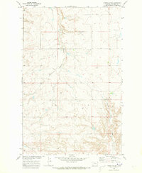
1970 Map of Dorner School
USGS Topo · Published 1973About this map
Dorner School stands as a focal point in this 1970 landscape of north-central Montana, situated near the boundary between Township 26 and 27 North. The terrain is defined by the intricate drainage patterns of East Dubout Coulee and Chimney Rock Coulee, which carve through the high plains of Chouteau County. This mapping, produced for the development of the Missouri River Basin, reveals a sparsely settled rural landscape where land use is concentrated around these seasonal watercourses.
Find a feature on this map
5 named features on this map. Tap any name to fly to it.
Don’t see what you’re looking for? This feature index may not catch every label — zoom into the map to look around manually.
Map Details
Editions of this 1970 Dorner School Map
This is the sole edition of this map. No revisions or reprints were ever made.
Other maps of this area

1886 · Great Falls
USGS Topo · 1:250,000

1890 · Fort Benton
USGS Topo · 1:250,000

1892 · Fort Benton
USGS Topo · 1:250,000

1897 · Fort Benton
USGS Topo · 1:250,000

1950 · Dent Bridge
USGS Topo · 1:62,500

1954 · Great Falls
USGS Topo · 1:250,000

1954 · Shelby
USGS Topo · 1:250,000

1957 · Great Falls
USGS Topo · 1:250,000

1958 · Shelby
USGS Topo · 1:250,000

1970 · Penzer School
USGS Topo · 1:24,000