
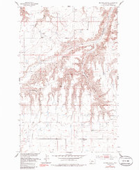
1953 Map of Big Bend School
USGS Topo · Published 1955About this map
Small rural schoolhouses and seasonal watercourses define this mid-century landscape in Chouteau County. Published as part of a Missouri River Basin development program, the area is characterized by deep erosional features like The Sag and Rattlesnake Coulee that cut through the high plains. Human activity is sparse and centered on isolated landmarks such as Big Bend School and Eagle Butte School, suggesting a late homestead-era pattern of life where students traveled significant distances across the open range.
Find a feature on this map
13 named features on this map. Tap any name to fly to it.
Don’t see what you’re looking for? This feature index may not catch every label — zoom into the map to look around manually.
Map Details
Editions of this 1953 Big Bend School Map
2 editions found
Other maps of this area

1890 · Fort Benton
USGS Topo · 1:250,000

1892 · Fort Benton
USGS Topo · 1:250,000

1897 · Fort Benton
USGS Topo · 1:250,000

1919 · Big Sandy
USGS Topo · 1:125,000

1953 · Boggs Island
USGS Topo · 1:24,000

1953 · Eagle Buttes
USGS Topo · 1:24,000

1953 · Verona
USGS Topo · 1:24,000

1953 · Lonetree Coulee
USGS Topo · 1:24,000

1953 · Pilot Rock
USGS Topo · 1:24,000

1953 · Stranahan
USGS Topo · 1:24,000