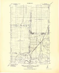
1919 Map of Big Sandy
USGS Topo · Published 1944About this map
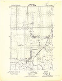
Big Sandy serves as the central hub on this 1919 tactical map, situated at the junction of Big Sandy Creek and the Great Northern Railway Line. The landscape is defined by the transition from the high plains of Hill Co. down to the deep incision of the Missouri River near the settlement of Virgelle. A sophisticated network of drainages and coulees, such as Fourteen Mile Coulee and Rainbow Coulee, illustrates the complex erosion patterns of the northern Montana prairie. Along the southern edge of the sheet, a Ferry crossing indicates a critical transport link over the Missouri before the widespread construction of bridges. The map reveals early 20th-century water management efforts through the Havre Reservoir and various unnamed reservoirs, reflecting the importance of irrigation and steam-locomotive supply in this semi-arid region. Small rail stops like Verona, Cairo, and Laredo provide a detailed look at the rail-dependent economy that sustained these rural townships after the turn of the century.
Find a feature on this map
25 named features on this map. Tap any name to fly to it.
Don’t see what you’re looking for? This feature index may not catch every label — zoom into the map to look around manually.
Map Details
Editions of this 1919 Big Sandy Map
2 editions found
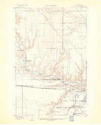
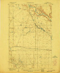
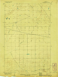
Other maps of this area

1890 · Fort Benton
USGS Topo · 1:250,000

1892 · Fort Benton
USGS Topo · 1:250,000

1897 · Fort Benton
USGS Topo · 1:250,000
1904 · Assinniboine
USGS Topo · 1:62,500

1904 · Boxelder
USGS Topo · 1:62,500
1906 · Kremlin
USGS Topo · 1:62,500
1906 · Lonesome
USGS Topo · 1:62,500

1906 · Boxelder
USGS Topo · 1:62,500

1912 · Thibedeau Lake
USGS Topo · 1:125,000
1919 · Big Sandy
USGS Topo · 1:125,000