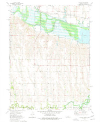
1974 Map of Alma SW
USGS Topo · Published 1977About this map
Harlan County Lake dominates the upper landscape of this 1974 survey, showing the reservoir at an elevation of 1946 feet. The Republican River enters the map from the west, feeding into the lake near the settlement of Orleans. The northern shoreline is shaped by several distinct water bodies, including Sappa Creek, Flag Creek, and Rope Creek, which intersect with the transport corridor of the Burlington Northern railroad.
Find a feature on this map
17 named features on this map. Tap any name to fly to it.
Don’t see what you’re looking for? This feature index may not catch every label — zoom into the map to look around manually.
Map Details
Editions of this 1974 Alma SW Map
This is the sole edition of this map. No revisions or reprints were ever made.
Other maps of this area

1893 · Norton
USGS Topo · 1:125,000

1893 · Phillipsburg
USGS Topo · 1:125,000

1896 · Holdrege
USGS Topo · 1:125,000

1896 · Arapahoe
USGS Topo · 1:125,000

1898 · Arapahoe
USGS Topo · 1:125,000

1955 · Grand Island
USGS Topo · 1:250,000

1955 · Beloit
USGS Topo · 1:250,000

1957 · Grand Island
USGS Topo · 1:250,000

1957 · Stamford SE
USGS Topo · 1:24,000

1958 · Grand Island
USGS Topo · 1:250,000