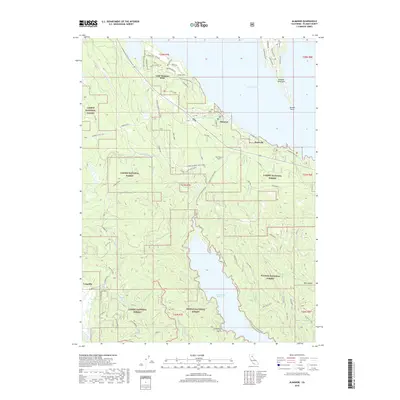
2018 Map of Almanor
USGS Topo · Published 2018About this map
The Almanor Peninsula and the western shores of Lake Almanor define this high-country landscape where the Lassen National Forest meets the Plumas National Forest. The settlement of Almanor and the community of Prattville serve as primary points of interest along the shoreline, while the isolated Longville sits further west near Soda Spring. The topography is shaped by the transition from the lake's edge to the deep drainage of the Butt Valley Reservoir, connected by the Butt Valley Tunnel and several prominent creeks including Butt Cr and Yellow Cr. A complex network of forest roads, such as Humboldt Rd and Humbug Rd, provides access to the interior, where the Red Rock site stands as a legacy of local mining activity. This geography highlights the late-20th-century development of leisure-oriented lakeside neighborhoods alongside established forest service management and hydroelectric infrastructure.
Find a feature on this map
60 named features on this map. Tap any name to fly to it.
Don’t see what you’re looking for? This feature index may not catch every label — zoom into the map to look around manually.
Map Details
Editions of this 2018 Almanor Map
This is the sole edition of this map. No revisions or reprints were ever made.
Other maps of this area

1886 · Lassen Peak
USGS Topo · 1:250,000

1892 · Lassen Peak
USGS Topo · 1:250,000

1894 · Lassen Peak
USGS Topo · 1:250,000

1955 · Almanor
USGS Topo · 1:62,500

1955 · Westwood
USGS Topo · 1:250,000

1956 · Mt. Harkness
USGS Topo · 1:62,500

1956 · Chester
USGS Topo · 1:62,500

1958 · Westwood
USGS Topo · 1:250,000

1958 · Jonesville
USGS Topo · 1:62,500

1959 · Westwood
USGS Topo · 1:250,000