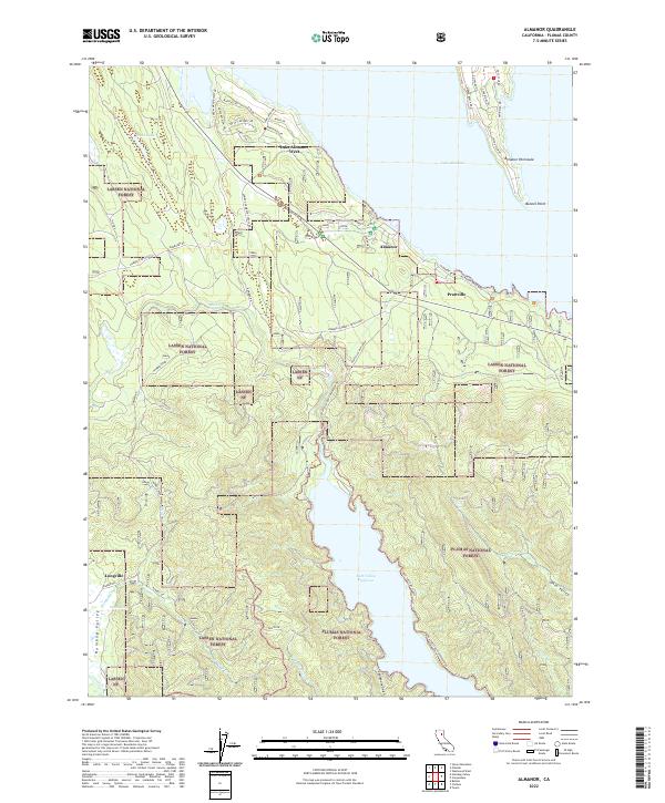
2022 Map of Almanor
USGS Topo · Published 2022About this map
Lake Almanor and the surrounding timberlands of the Lassen National Forest define this high-altitude landscape in Plumas County. The settlement of Prattville sits along the southwestern shore, connected by Prattville Butt Reservoir Rd to the southern Butt Valley Reservoir. This area reflects a decades-long integration of water management and recreation, with established communities like Almanor and Lake Almanor West serving as focal points for residential and seasonal development.
Find a feature on this map
54 named features on this map. Tap any name to fly to it.
Don’t see what you’re looking for? This feature index may not catch every label — zoom into the map to look around manually.
Map Details
Editions of this 2022 Almanor Map
This is the sole edition of this map. No revisions or reprints were ever made.
Other maps of this area

1886 · Lassen Peak
USGS Topo · 1:250,000

1892 · Lassen Peak
USGS Topo · 1:250,000

1894 · Lassen Peak
USGS Topo · 1:250,000

1955 · Almanor
USGS Topo · 1:62,500

1955 · Westwood
USGS Topo · 1:250,000

1956 · Mt. Harkness
USGS Topo · 1:62,500

1956 · Chester
USGS Topo · 1:62,500

1958 · Westwood
USGS Topo · 1:250,000

1958 · Jonesville
USGS Topo · 1:62,500

1959 · Westwood
USGS Topo · 1:250,000