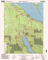
1994 Map of Almanor
USGS Topo · Published 1998About this map
Lake Almanor and the industrial infrastructure of the North Fork Feather River watershed dominate this mid-1990s landscape within the Lassen National Forest. The map documents a complex hydro-electric network, following the flow from the Intake Tower near Prattville through a Tunnel and Penstock to the Powerhouse at the head of the Butt Valley Reservoir. This engineering footprint is set against a backdrop of historic timber and ranching routes like the Humboldt Road.
Find a feature on this map
43 named features on this map. Tap any name to fly to it.
Don’t see what you’re looking for? This feature index may not catch every label — zoom into the map to look around manually.
Map Details
Editions of this 1994 Almanor Map
2 editions found
Other maps of this area

1886 · Lassen Peak
USGS Topo · 1:250,000

1892 · Lassen Peak
USGS Topo · 1:250,000

1894 · Lassen Peak
USGS Topo · 1:250,000

1955 · Almanor
USGS Topo · 1:62,500

1955 · Westwood
USGS Topo · 1:250,000

1956 · Mt. Harkness
USGS Topo · 1:62,500

1956 · Chester
USGS Topo · 1:62,500

1958 · Westwood
USGS Topo · 1:250,000

1958 · Jonesville
USGS Topo · 1:62,500

1959 · Westwood
USGS Topo · 1:250,000