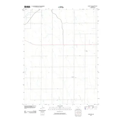
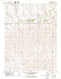
2009 Map of Almena SW
USGS Topo · Published 2009About this map
Prairie Dog Creek and its southern branch, the South Fork Prairie Dog Creek, define the drainage patterns of this Norton County landscape. The area is characterized by a grid-like road network and agricultural parcels, punctuated by small waterways like Wildcat Creek and Buffalo Creek. This 2009 survey highlights several important sites for local history and genealogy, including Zellmer Cemetery in the eastern section and Mount Olive Cemetery further south. The map illustrates how late-20th-century infrastructure, such as RD M and RD E 11, integrates with the natural flow of Scull Creek and other local tributaries.
Find a feature on this map
21 named features on this map. Tap any name to fly to it.
Don’t see what you’re looking for? This feature index may not catch every label — zoom into the map to look around manually.
Map Details
Editions of this 2009 Almena SW Map
This is the sole edition of this map. No revisions or reprints were ever made.
Other maps of this area

1893 · Norton
USGS Topo · 1:125,000

1951 · Norton
USGS Topo · 1:62,500

1955 · Beloit
USGS Topo · 1:250,000

1959 · Beloit
USGS Topo · 1:250,000
1967 · Norton NE
USGS Topo · 1:24,000
1967 · Almena
USGS Topo · 1:24,000
1967 · Long Island
USGS Topo · 1:24,000

1978 · Logan
USGS Topo · 1:24,000
1978 · Calvert
USGS Topo · 1:24,000

1978 · Edmond
USGS Topo · 1:24,000