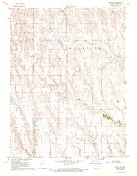
1967 Map of Norton NE
USGS Topo · Published 1969About this map
Sheley Cem sits at the heart of this landscape, a quiet landmark within the rural northern Kansas countryside during the late 1960s. The map illustrates a high prairie terrain divided into townships, including Aldine, Harrison, Emmett, and Center. These political boundaries overlay a natural drainage system defined by the North Fork Prairie Dog Creek and its tributary, Spring Branch. This 1967 field-checked survey highlights the traditional section-line road grid that characterizes the region's agricultural layout, providing a precise look at the rural property lines and water sources vital to the local farming community.
Find a feature on this map
7 named features on this map. Tap any name to fly to it.
Don’t see what you’re looking for? This feature index may not catch every label — zoom into the map to look around manually.
Map Details
Editions of this 1967 Norton NE Map
This is the sole edition of this map. No revisions or reprints were ever made.
Other maps of this area

1893 · Norton
USGS Topo · 1:125,000

1896 · Arapahoe
USGS Topo · 1:125,000

1898 · Arapahoe
USGS Topo · 1:125,000

1951 · Norton
USGS Topo · 1:62,500

1955 · Grand Island
USGS Topo · 1:250,000

1955 · Beloit
USGS Topo · 1:250,000

1957 · Grand Island
USGS Topo · 1:250,000
1957 · Beaver City SW
USGS Topo · 1:24,000

1957 · Precept
USGS Topo · 1:24,000

1957 · Beaver City SE
USGS Topo · 1:24,000