
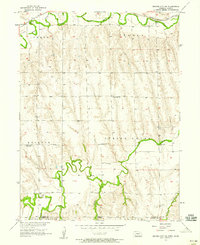
1957 Map of Beaver City SE
USGS Topo · Published 1958About this map
Sappa Creek and Beaver Creek wind across this prairie landscape along the border of Nebraska and Kansas during the late 1950s. The terrain is defined by the organized township structure of Furnas County and Norton County, showing a rural settlement pattern established long before the mid-century. The Chicago Burlington and Quincy railroad cuts through the northern section, following the natural course of the water, a common trait for early transportation in the High Plains. This survey reveals the distribution of localized civic centers, such as Meents, and small educational hubs like Needmore Sch and McCarty Sch, which served the surrounding farming townships of Spring Green, Richmond, and Beaver City. These schools and tiny settlements represent the social foundations of the region's agricultural economy at a time when small rural districts were still the backbone of local life.
Find a feature on this map
15 named features on this map. Tap any name to fly to it.
Don’t see what you’re looking for? This feature index may not catch every label — zoom into the map to look around manually.
Map Details
Editions of this 1957 Beaver City SE Map
This is the sole edition of this map. No revisions or reprints were ever made.
Other maps of this area

1893 · Norton
USGS Topo · 1:125,000

1896 · Arapahoe
USGS Topo · 1:125,000

1898 · Arapahoe
USGS Topo · 1:125,000

1951 · Norton
USGS Topo · 1:62,500

1955 · Grand Island
USGS Topo · 1:250,000

1955 · Beloit
USGS Topo · 1:250,000

1957 · Grand Island
USGS Topo · 1:250,000
1957 · Beaver City SW
USGS Topo · 1:24,000

1957 · Precept
USGS Topo · 1:24,000

1958 · Grand Island
USGS Topo · 1:250,000