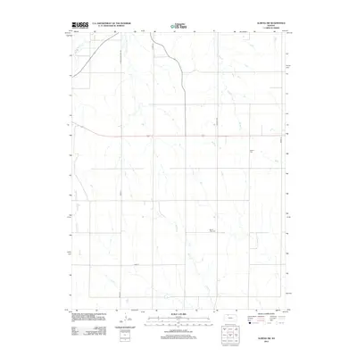
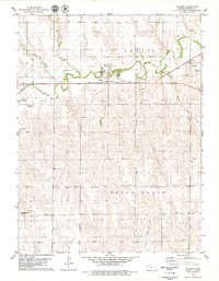
2012 Map of Almena SW
USGS Topo · Published 2012About this map
The agrarian landscape of Norton County is defined by its dendritic drainage systems, most notably Prairie Dog Cr and its tributary, S Fork Prairie Dog Cr, which carve through the plains. The 2012 survey illustrates a sparse settlement pattern dominated by a section-line road grid, including S Main St and Road E 14, reflecting the enduring structure of High Plains agriculture. For genealogists and local historians, the presence of Mount Olive Cem and Zellmer Cem provides specific points of interest for tracing early family histories in this rural township. Numerous ephemeral waterways like Cactus Cr, Buffalo Cr, and Wildcat Cr navigate the terrain, indicating the natural flow of the land in an area where water management and cattle grazing remain central to the local economy.
Find a feature on this map
13 named features on this map. Tap any name to fly to it.
Don’t see what you’re looking for? This feature index may not catch every label — zoom into the map to look around manually.
Map Details
Editions of this 2012 Almena SW Map
This is the sole edition of this map. No revisions or reprints were ever made.
Other maps of this area

1893 · Norton
USGS Topo · 1:125,000

1951 · Norton
USGS Topo · 1:62,500

1955 · Beloit
USGS Topo · 1:250,000

1959 · Beloit
USGS Topo · 1:250,000
1967 · Norton NE
USGS Topo · 1:24,000
1967 · Almena
USGS Topo · 1:24,000
1967 · Long Island
USGS Topo · 1:24,000

1978 · Logan
USGS Topo · 1:24,000
1978 · Calvert
USGS Topo · 1:24,000

1978 · Edmond
USGS Topo · 1:24,000