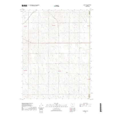
2018 Map of Almena SW
USGS Topo · Published 2018About this map
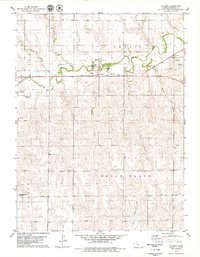
Prairie Dog Cr and its southern fork carve through the northern reaches of this Kansas landscape, defining a topography of drainage systems that flow toward the Buffalo Cr basin. This 2018 survey reveals the rural character of the borderlands between Norton and Phillips counties, where a geometric grid of section roads like Road N and Rd E 11 organizes the agricultural terrain. Two primary burial grounds, Zellmer Cem in the northeast and Mount Olive Cem in the center, serve as quiet landmarks for local genealogy and historical research. Smaller waterways including Cactus Cr, Wildcat Cr, and Skull Cr further detail the watershed patterns, while Highway 36 and Highway 383 provide the primary transit corridors through these high plains townships.
Find a feature on this map
34 named features on this map. Tap any name to fly to it.
Don’t see what you’re looking for? This feature index may not catch every label — zoom into the map to look around manually.
Map Details
Editions of this 2018 Almena SW Map
This is the sole edition of this map. No revisions or reprints were ever made.
Other maps of this area

1893 · Norton
USGS Topo · 1:125,000

1951 · Norton
USGS Topo · 1:62,500

1955 · Beloit
USGS Topo · 1:250,000

1959 · Beloit
USGS Topo · 1:250,000
1967 · Norton NE
USGS Topo · 1:24,000
1967 · Almena
USGS Topo · 1:24,000
1967 · Long Island
USGS Topo · 1:24,000

1978 · Logan
USGS Topo · 1:24,000
1978 · Calvert
USGS Topo · 1:24,000

1978 · Edmond
USGS Topo · 1:24,000