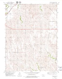
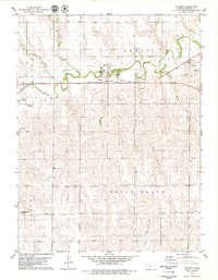
1978 Map of Almena SW
USGS Topo · Published 1979About this map
The agrarian landscape of Norton County, Kansas, is defined here by the winding course of Prairie Dog Creek and its tributary, South Fork Prairie Dog Creek. In this rural expanse, the small settlements of Calvert and Buralo anchor the local community, while the industrial and transport needs of the late 1970s are represented by the Chicago Rock Island and Pacific railroad lines cutting through the northern reaches. The map reflects a typical Midwestern township structure, showing a mix of resource extraction at the Gravel Pit and Sandpit alongside established centers of local heritage.
Find a feature on this map
23 named features on this map. Tap any name to fly to it.
Don’t see what you’re looking for? This feature index may not catch every label — zoom into the map to look around manually.
Map Details
Editions of this 1978 Almena SW Map
This is the sole edition of this map. No revisions or reprints were ever made.
Other maps of this area

1893 · Norton
USGS Topo · 1:125,000

1951 · Norton
USGS Topo · 1:62,500

1955 · Beloit
USGS Topo · 1:250,000

1959 · Beloit
USGS Topo · 1:250,000
1967 · Norton NE
USGS Topo · 1:24,000
1967 · Almena
USGS Topo · 1:24,000
1967 · Long Island
USGS Topo · 1:24,000

1978 · Logan
USGS Topo · 1:24,000
1978 · Calvert
USGS Topo · 1:24,000

1978 · Edmond
USGS Topo · 1:24,000