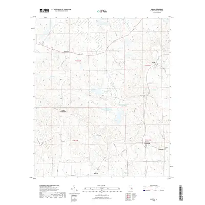
2018 Map of Almeria
USGS Topo · Published 2018About this map
Almeria and surrounding Bullock County settlements are depicted here as they appeared in 2018, characterized by a traditional Southern landscape of small crossroads and family cemeteries. The area is defined by a dense network of watercourses including Leatherbreeches Cr, Bughall Cr, and Pinhook Cr, which feed into various man-made reservoirs like Paulk Lake and Henderson Lake. These water sources highlight the agricultural and land-management focus of the region, specifically through infrastructure such as the Old Town Cr Watershed Lake Number 25.
Find a feature on this map
56 named features on this map. Tap any name to fly to it.
Don’t see what you’re looking for? This feature index may not catch every label — zoom into the map to look around manually.
Map Details
Editions of this 2018 Almeria Map
This is the sole edition of this map. No revisions or reprints were ever made.
Other maps of this area

1953 · Dothan
USGS Topo · 1:250,000

1954 · Dothan
USGS Topo · 1:250,000

1955 · Dothan
USGS Topo · 1:250,000

1955 · Phenix City
USGS Topo · 1:250,000

1957 · Phenix City
USGS Topo · 1:250,000

1958 · Phenix City
USGS Topo · 1:250,000

1968 · Perote
USGS Topo · 1:24,000
1968 · Saco
USGS Topo · 1:24,000
1968 · Needmore
USGS Topo · 1:24,000
1971 · China Grove
USGS Topo · 1:24,000