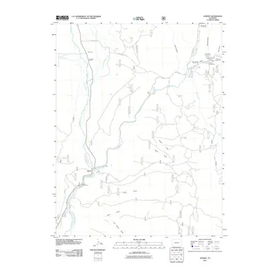
2011 Map of Almont
USGS Topo · Published 2011About this map
Almont serves as the focal point of this 2011 survey, situated at the confluence where the Taylor River and East River join to form the Gunnison River. This hydrological junction has long defined the local economy and settlement patterns, supporting a network of recreational sites such as Almont Campground and the Taylor Canyon Campground. To the north, the small settlement of Jacks Cabin and the nearby Jacks Cabin Cemetery provide evidence of early ranching and community life in this high-altitude corridor.
Find a feature on this map
37 named features on this map. Tap any name to fly to it.
Don’t see what you’re looking for? This feature index may not catch every label — zoom into the map to look around manually.
Map Details
Editions of this 2011 Almont Map
This is the sole edition of this map. No revisions or reprints were ever made.
Other maps of this area

1888 · Crested Butte
USGS Topo · 1:62,500

1889 · Crested Butte
USGS Topo · 1:62,500

1893 · Crested Butte
USGS Topo · 1:62,500

1934 · Taylor Park
USGS Topo · 1:62,500

1937 · Taylor Park
USGS Topo · 1:62,500

1941 · Pitkin
USGS Topo · 1:62,500

1945 · Pitkin
USGS Topo · 1:62,500

1954 · Gunnison
USGS Topo · 1:24,000

1956 · Montrose
USGS Topo · 1:250,000

1959 · Montrose
USGS Topo · 1:250,000