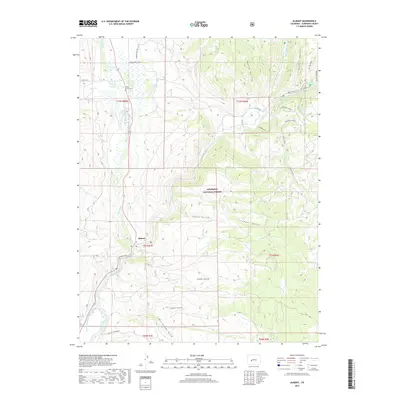
2019 Map of Almont
USGS Topo · Published 2019About this map
The confluence of the East River and the Taylor River forms the beginning of the Gunnison River at the settlement of Almont. This hydrologic junction is the central focus of the landscape, where water management features like the E River Number 1 Ditch and the Gunnison Highline Canal indicate the area's historical reliance on irrigation. Within the boundaries of the Gunnison National Forest, the terrain is defined by deep drainages such as Taylor Canyon, Cougar Canyon, and several named gulches including Tepee Gulch and Lost Canyon Gulch. Local history and genealogy interests are represented by the Jacks Cabin Cem, located near the northern edge of the map. Significant landmarks such as Harmels Point and Doctor Park overlook the river valleys, while local transport is traced through routes like the Jacks Cabin Cutoff and Roaring Judy Rd.
Find a feature on this map
38 named features on this map. Tap any name to fly to it.
Don’t see what you’re looking for? This feature index may not catch every label — zoom into the map to look around manually.
Map Details
Editions of this 2019 Almont Map
This is the sole edition of this map. No revisions or reprints were ever made.
Other maps of this area

1888 · Crested Butte
USGS Topo · 1:62,500

1889 · Crested Butte
USGS Topo · 1:62,500

1893 · Crested Butte
USGS Topo · 1:62,500

1934 · Taylor Park
USGS Topo · 1:62,500

1937 · Taylor Park
USGS Topo · 1:62,500

1941 · Pitkin
USGS Topo · 1:62,500

1945 · Pitkin
USGS Topo · 1:62,500

1954 · Gunnison
USGS Topo · 1:24,000

1956 · Montrose
USGS Topo · 1:250,000

1959 · Montrose
USGS Topo · 1:250,000