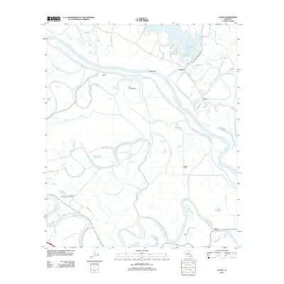
2012 Map of Aloha
USGS Topo · Published 2012About this map
Cane River and the Red River dominate this Louisiana landscape, creating a complex network of bayous and oxbow lakes south of Nantachie Lake. The map illustrates a region defined by its alluvial geography, where the Cane River-Red Bayou Diversion Canal and the Marco Canal manage the flow of water through low-lying areas like Ash Brake Bottom and Flat Bayou. Small riverside settlements including Aloha, Waddel, and Marco are connected by a web of local routes such as Little Eva Plantation Rd and Marco Levee Rd. This 2012 survey captures the continued agricultural and industrial character of the parish, featuring the Little Eva Plantation Landing Strip and the Aloha Oil Field. Genealogists may find particular value in the location of the Marco Cem near the banks of the Cane River.
Find a feature on this map
66 named features on this map. Tap any name to fly to it.
Don’t see what you’re looking for? This feature index may not catch every label — zoom into the map to look around manually.
Map Details
Editions of this 2012 Aloha Map
This is the sole edition of this map. No revisions or reprints were ever made.
Other maps of this area

1932 · Colfax SW
USGS Topo · 1:31,680

1932 · Colfax NW
USGS Topo · 1:31,680

1935 · Verda
USGS Topo · 1:31,680

1936 · Colfax
USGS Topo · 1:62,500

1937 · Chopin NE
USGS Topo · 1:31,680

1937 · Chopin NW
USGS Topo · 1:31,680

1937 · Aloha
USGS Topo · 1:31,680

1937 · Montgomery
USGS Topo · 1:62,500

1937 · Cloutierville
USGS Topo · 1:31,680

1941 · Boyce
USGS Topo · 1:62,500