
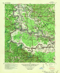
1941 Map of Boyce
USGS Topo · Published 1945About this map
The Red River snakes through the heart of Rapides Parish, defining a landscape of alluvial plantations and upland forests just before the mid-century. This 1941 survey details a complex social geography where the river and rail lines—the Texas and Pacific Railroad and Louisiana and Arkansas Railway—dictated the placement of communities like Boyce and Zimmerman. The transition from the fertile lowlands of Fairmount Plantation and Village Plantation to the timbered heights of the Kisatchie National Forest Catahoula Division is marked by a dense network of country institutions. Numerous segregated and community centers appear, such as Little Rock Ch & Sch and Israelite Ch Sch & Cem, while the burgeoning infrastructure of the era is evidenced by the Alexandria Municipal Airport and the sprawling grounds of the Central Hospital For Insane near Graham.
Find a feature on this map
123 named features on this map. Tap any name to fly to it.
Don’t see what you’re looking for? This feature index may not catch every label — zoom into the map to look around manually.
Map Details
Editions of this 1941 Boyce Map
2 editions found
Other maps of this area

1932 · Boyce NE
USGS Topo · 1:31,680

1932 · Boyce SW
USGS Topo · 1:31,680

1932 · Colfax SW
USGS Topo · 1:31,680

1932 · Colfax SE
USGS Topo · 1:31,680

1935 · Lecompte
USGS Topo · 1:62,500

1936 · Colfax
USGS Topo · 1:62,500

1936 · Pollock
USGS Topo · 1:62,500

1937 · Chopin NE
USGS Topo · 1:31,680

1937 · Aloha
USGS Topo · 1:31,680

1937 · Montgomery
USGS Topo · 1:62,500