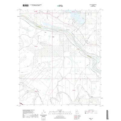
2020 Map of Aloha
USGS Topo · Published 2020About this map
Red River and the Cane River define this complex alluvial landscape along the border of Grant and Natchitoches Parishes. The terrain is a labyrinth of backwaters and oxbows, featuring numerous named water bodies like Nantachie Lake, Chicot Lake, and Lake Morantine. Small settlements such as Aloha, Marco, and Odra are positioned near the waterways, reflecting the region's historic reliance on river systems for commerce and agriculture. The map documents a highly managed floodplain, where the Red River Levee Rd runs parallel to the primary channel, protecting the low-lying Ash Brake Bottom and surrounding wetlands. Genealogists and local historians can find site-specific details such as the Marce Cem near Marco and family-associated landmarks like the Little Eva Plantation Rd, providing a clear record of land use and habitation patterns in this riverine corridor during the early 21st century.
Find a feature on this map
78 named features on this map. Tap any name to fly to it.
Don’t see what you’re looking for? This feature index may not catch every label — zoom into the map to look around manually.
Map Details
Editions of this 2020 Aloha Map
This is the sole edition of this map. No revisions or reprints were ever made.
Other maps of this area

1932 · Colfax SW
USGS Topo · 1:31,680

1932 · Colfax NW
USGS Topo · 1:31,680

1935 · Verda
USGS Topo · 1:31,680

1936 · Colfax
USGS Topo · 1:62,500

1937 · Chopin NE
USGS Topo · 1:31,680

1937 · Chopin NW
USGS Topo · 1:31,680

1937 · Aloha
USGS Topo · 1:31,680

1937 · Montgomery
USGS Topo · 1:62,500

1937 · Cloutierville
USGS Topo · 1:31,680

1941 · Boyce
USGS Topo · 1:62,500