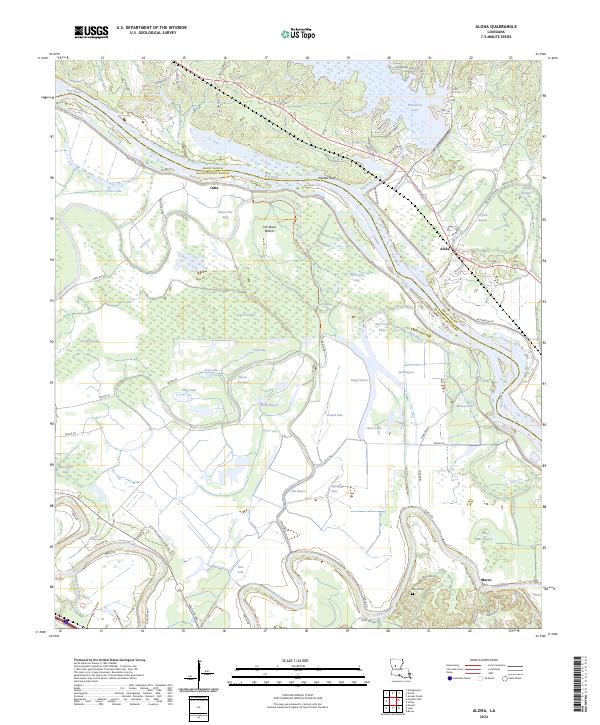
2024 Map of Aloha
USGS Topo · Published 2024About this map
The Red River creates a complex network of wetlands and oxbow lakes as it winds along the border of Grant and Natchitoches Parishes. Much of this alluvial landscape is preserved within the Red River National Wildlife Refuge, where a dense concentration of water bodies like Lake Cocodrie, Big Trudo Lake, and Chicot Lake reveals the river's historical shifts. Settlement is clustered on higher ground near Aloha and Marco, while the northern terrain is defined by Waddel Bluff overlooking the Ash Brake Bottom. The southern reach of the sheet is dominated by the course of the Cane River, which runs parallel to the primary river system. Local landmarks include the Nantacie Dam on Nantachie Lake and the Marce Cem, providing important touchstones for researchers tracing family history in this corner of Louisiana.
Find a feature on this map
83 named features on this map. Tap any name to fly to it.
Don’t see what you’re looking for? This feature index may not catch every label — zoom into the map to look around manually.
Map Details
Editions of this 2024 Aloha Map
This is the sole edition of this map. No revisions or reprints were ever made.
Other maps of this area

1932 · Colfax SW
USGS Topo · 1:31,680

1932 · Colfax NW
USGS Topo · 1:31,680

1935 · Verda
USGS Topo · 1:31,680

1936 · Colfax
USGS Topo · 1:62,500

1937 · Chopin NE
USGS Topo · 1:31,680

1937 · Chopin NW
USGS Topo · 1:31,680

1937 · Aloha
USGS Topo · 1:31,680

1937 · Montgomery
USGS Topo · 1:62,500

1937 · Cloutierville
USGS Topo · 1:31,680

1941 · Boyce
USGS Topo · 1:62,500