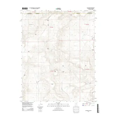
2013 Map of Alps Mesa
USGS Topo · Published 2013About this map
Alps Mesa stands as a prominent topographical landmark along the high borderlands where Colorado meets New Mexico. This 2013 survey reveals a landscape defined by dramatic elevation changes, characterized by a series of isolated mesas and deep, winding canyons. Significant features like Hoodoo Mtn, Klondike Mesa, and Umbrella Mesa showcase the distinctive erosion patterns of the region. The map documents the vital water sources in this arid environment, including Starr Spring, Wheeler Springs, and the seasonal drainage of Chaney Arroyo. Human activity is primarily traced through the network of county and state routes, such as CO Highway B-033 and NM-551, which navigate around rugged landmarks like Toll Gate Canyon and Tijeras Rincon. The absence of large town centers emphasizes the area's rural character, centered around named terrain features like Dougherty and Chavez Mesa.
Find a feature on this map
34 named features on this map. Tap any name to fly to it.
Don’t see what you’re looking for? This feature index may not catch every label — zoom into the map to look around manually.
Map Details
Editions of this 2013 Alps Mesa Map
This is the sole edition of this map. No revisions or reprints were ever made.
Other maps of this area

1891 · Mesa De Maya
USGS Topo · 1:125,000

1892 · Elmoro
USGS Topo · 1:125,000

1893 · Elmoro
USGS Topo · 1:125,000

1893 · Mesa de Maya
USGS Topo · 1:125,000

1897 · Elmoro
USGS Topo · 1:125,000

1954 · Raton
USGS Topo · 1:250,000

1954 · Trinidad
USGS Topo · 1:250,000

1954 · Dalhart
USGS Topo · 1:250,000

1955 · La Junta
USGS Topo · 1:250,000

1955 · Trinidad
USGS Topo · 1:250,000