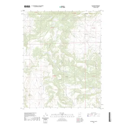
2023 Map of Alps Mesa
USGS Topo · Published 2023About this map
Davis Mesa and Alps Mesa dominate this high-altitude landscape along the border of New Mexico and Colorado. The terrain is defined by a series of prominent landforms including Klondike Mesa and the uniquely named Hoodoo Mtn. Historical land use and travel are evidenced by the presence of Emery Gap Cem and the natural passage at Toll Gate Canyon. The region's hydrology is marked by ephemeral and perennial sources such as Wheeler Springs, Starr Spring, and Fisher Creek, which carve deep drainage patterns like Sawmill Canyon and Starr Canyon. This modern survey details the rugged boundary between Las Animas County and Union County, showing the network of local routes like Co RD 8030 that navigate the complex system of mesas and rincons.
Find a feature on this map
34 named features on this map. Tap any name to fly to it.
Don’t see what you’re looking for? This feature index may not catch every label — zoom into the map to look around manually.
Map Details
Editions of this 2023 Alps Mesa Map
This is the sole edition of this map. No revisions or reprints were ever made.
Other maps of this area

1891 · Mesa De Maya
USGS Topo · 1:125,000

1892 · Elmoro
USGS Topo · 1:125,000

1893 · Elmoro
USGS Topo · 1:125,000

1893 · Mesa de Maya
USGS Topo · 1:125,000

1897 · Elmoro
USGS Topo · 1:125,000

1954 · Raton
USGS Topo · 1:250,000

1954 · Trinidad
USGS Topo · 1:250,000

1954 · Dalhart
USGS Topo · 1:250,000

1955 · La Junta
USGS Topo · 1:250,000

1955 · Trinidad
USGS Topo · 1:250,000