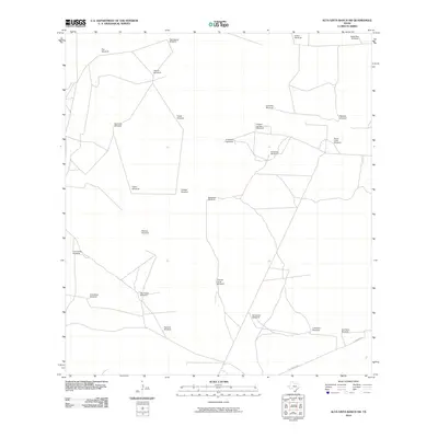
2010 Map of Alta Vista Ranch SW
USGS Topo · Published 2010About this map
Windmills define the landscape of this portion of Jim Hogg County, tracing a sparse but vital network of water sources across the South Texas brush country. The distribution of these named features, such as Pita Windmill and Palo Blanco Windmill, reveals the underlying ranching infrastructure essential to survival in this arid region. Aside from the presence of La Lumbrita Rd in the southern section, the map shows a quiet, undeveloped expanse where life is centered around these isolated water points. Many of these landmarks, including Cabeza de Toro Windmill and Trampa Verde Windmill, likely represent long-standing family ranching operations. The intricate web of local tracks connecting stations like San Rafael Windmill and Blanco Windmill illustrates how the land was managed and navigated in the early 21st century, maintaining a traditional ranching economy into the modern era.
Find a feature on this map
26 named features on this map. Tap any name to fly to it.
Don’t see what you’re looking for? This feature index may not catch every label — zoom into the map to look around manually.
Map Details
Editions of this 2010 Alta Vista Ranch SW Map
This is the sole edition of this map. No revisions or reprints were ever made.
Other maps of this area

1938 · Agua Nueva
USGS Topo · 1:62,500

1938 · Cuevitas
USGS Topo · 1:62,500

1939 · Randado
USGS Topo · 1:62,500

1940 · Randado
USGS Topo · 1:62,500

1949 · Mc Allen
USGS Topo · 1:250,000

1954 · McAllen
USGS Topo · 1:250,000

1956 · Laredo
USGS Topo · 1:250,000

1957 · Mc Allen
USGS Topo · 1:250,000

1962 · McAllen
USGS Topo · 1:250,000

1972 · Armstrong Ranch
USGS Topo · 1:24,000