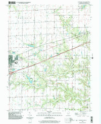
1998 Map of Altamont East
USGS Topo · Published 2003About this map
Altamont anchors this Effingham County landscape, serving as a hub where major transportation routes and local commerce converge. The map documents a sophisticated water management system for the era, featuring the Altamont Reservoir, the Old Altamont Reservoir, and a dedicated Water Filtration Plant. These engineering works, along with the Sewage Disposal Ponds, indicate the municipal growth of the area at the close of the 20th century.
Find a feature on this map
26 named features on this map. Tap any name to fly to it.
Don’t see what you’re looking for? This feature index may not catch every label — zoom into the map to look around manually.
Map Details
Editions of this 1998 Altamont East Map
This is the sole edition of this map. No revisions or reprints were ever made.
Other maps of this area

1941 · St. Elmo
USGS Topo · 1:62,500

1945 · St. Elmo
USGS Topo · 1:62,500

1945 · Kinmundy
USGS Topo · 1:62,500

1947 · Kinmundy
USGS Topo · 1:62,500

1950 · Effingham
USGS Topo · 1:62,500

1951 · Effingham
USGS Topo · 1:62,500

1956 · Edgewood
USGS Topo · 1:62,500

1958 · Decatur
USGS Topo · 1:250,000

1958 · Belleville
USGS Topo · 1:250,000

1961 · Decatur
USGS Topo · 1:250,000