
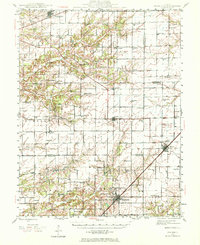
1945 Map of Kinmundy
USGS Topo · Published 1965About this map
The Pennsylvania and Illinois Central rail corridors anchor the rural development of Fayette and Marion Counties at the end of World War II. Large townships such as Wheatland, Wilberton, and Lone Grove are defined by a dense network of country schools, including Brush College Sch and Wolf Sch, indicating a peak era of decentralized local education before mid-century consolidation. The landscape is carved by the Kaskaskia River and tributaries like Hickory Creek, which dictate the placement of early settlements and family landmarks.
Find a feature on this map
81 named features on this map. Tap any name to fly to it.
Don’t see what you’re looking for? This feature index may not catch every label — zoom into the map to look around manually.
Map Details
Editions of this 1945 Kinmundy Map
2 editions found
Other maps of this area

1914 · Centralia
USGS Topo · 1:62,500

1934 · Salem
USGS Topo · 1:62,500

1935 · Centralia
USGS Topo · 1:62,500

1938 · Salem
USGS Topo · 1:62,500

1941 · St. Elmo
USGS Topo · 1:62,500

1944 · Ramsey
USGS Topo · 1:62,500

1945 · St. Elmo
USGS Topo · 1:62,500

1945 · Vandalia
USGS Topo · 1:62,500

1946 · Ramsey
USGS Topo · 1:62,500

1947 · Vandalia
USGS Topo · 1:62,500