
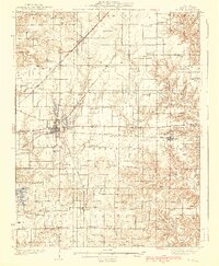
1938 Map of Salem
USGS Topo · Published 1938About this map
Salem serves as the central hub for this portion of Marion County, where the crossing of three major rail lines—the Baltimore and Ohio, Chicago and Eastern Illinois, and Illinois Central—dictated the local economy. The landscape is dotted with a dense network of rural infrastructure, from the County Infirmary south of town to numerous family-named landmarks like Givens Chapel and Martin Cem.
Find a feature on this map
96 named features on this map. Tap any name to fly to it.
Don’t see what you’re looking for? This feature index may not catch every label — zoom into the map to look around manually.
Map Details
Editions of this 1938 Salem Map
2 editions found
Other maps of this area

1914 · Centralia
USGS Topo · 1:62,500

1933 · Mount Vernon
USGS Topo · 1:48,000

1934 · Salem
USGS Topo · 1:62,500

1935 · Centralia
USGS Topo · 1:62,500

1940 · Mount Vernon
USGS Topo · 1:62,500

1943 · Ashley
USGS Topo · 1:62,500

1945 · Kinmundy
USGS Topo · 1:62,500

1945 · Vandalia
USGS Topo · 1:62,500

1946 · Ashley
USGS Topo · 1:62,500

1947 · Vandalia
USGS Topo · 1:62,500