
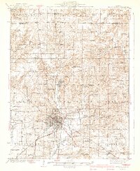
1940 Map of Mount Vernon
USGS Topo · Published 1940About this map
Mount Vernon serves as the focal point of this 1940 edition, shown as a thriving regional hub where the Southern and Southwestern railroads converge. The surrounding Jefferson County landscape is meticulously detailed, revealing a dense network of rural infrastructure typical of the early 20th century. Numerous one-room schoolhouses, such as George College Sch and Little Prairie Sch, are scattered across the townships, reflecting the era's localized educational system.
Find a feature on this map
122 named features on this map. Tap any name to fly to it.
Don’t see what you’re looking for? This feature index may not catch every label — zoom into the map to look around manually.
Map Details
Editions of this 1940 Mount Vernon Map
2 editions found
Other maps of this area

1914 · Centralia
USGS Topo · 1:62,500

1926 · Duquoin
USGS Topo · 1:62,500

1933 · Mount Vernon
USGS Topo · 1:48,000

1934 · Salem
USGS Topo · 1:62,500

1935 · Centralia
USGS Topo · 1:62,500

1938 · Salem
USGS Topo · 1:62,500

1939 · Ina
USGS Topo · 1:62,500

1942 · McLeansboro
USGS Topo · 1:62,500

1943 · Ina
USGS Topo · 1:62,500

1943 · Ashley
USGS Topo · 1:62,500