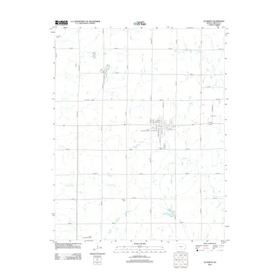
2012 Map of Altamont
USGS Topo · Published 2012About this map
Altamont serves as the central hub of this Labette County landscape, where the grid of the town site meets the sprawling agricultural layout of Southeast Kansas. The map documents several important community landmarks, including the Labette County Fairgrounds and the local Post Office located near the intersection of 6th St and Huston St. Outside the town center, the terrain is defined by the drainage patterns of Spring Creek, Deer Creek, and Richland Creek, which wind through a section-line road network. Genealogists will find a high density of burial sites scattered across the township, such as Hopewell Cemetery in the northwest and Elston Cemetery to the east. The southern portion of the quadrangle includes the Edna Municipal Airport and Idle Hour Lake, reflecting a mix of mid-century infrastructure and local water management.
Find a feature on this map
44 named features on this map. Tap any name to fly to it.
Don’t see what you’re looking for? This feature index may not catch every label — zoom into the map to look around manually.
Map Details
Editions of this 2012 Altamont Map
This is the sole edition of this map. No revisions or reprints were ever made.
Other maps of this area

1886 · Parsons
USGS Topo · 1:125,000

1893 · Parsons
USGS Topo · 1:125,000

1943 · McCune
USGS Topo · 1:62,500

1944 · Oswego
USGS Topo · 1:62,500

1945 · Mc Cune
USGS Topo · 1:62,500

1945 · Parsons
USGS Topo · 1:62,500

1946 · Oswego
USGS Topo · 1:48,000

1946 · Parsons
USGS Topo · 1:62,500

1946 · Mound Valley
USGS Topo · 1:62,500

1947 · Parsons
USGS Topo · 1:62,500