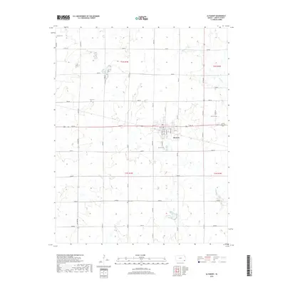
2018 Map of Altamont
USGS Topo · Published 2018About this map
Altamont serves as the central hub of this Labette County landscape, where a precise grid of residential streets like W Wells St and Wabash Ave gives way to the expansive agricultural sections of southeastern Kansas. The distribution of small family and community burial grounds across the township suggests a long history of local settlement, from Hopewell Cem in the northwest to Wooden Cem in the south. The terrain is defined by the gentle drainage patterns of Richland Cr, Deer Cr, and Spring Cr, which meander through the sections. While modern road designations like 14000 Rd and Jackson Rd now dominate the map, they follow the original section lines of the Public Land Survey System, preserving the 19th-century organization of the Kansas prairie.
Find a feature on this map
40 named features on this map. Tap any name to fly to it.
Don’t see what you’re looking for? This feature index may not catch every label — zoom into the map to look around manually.
Map Details
Editions of this 2018 Altamont Map
This is the sole edition of this map. No revisions or reprints were ever made.
Other maps of this area

1886 · Parsons
USGS Topo · 1:125,000

1893 · Parsons
USGS Topo · 1:125,000

1943 · McCune
USGS Topo · 1:62,500

1944 · Oswego
USGS Topo · 1:62,500

1945 · Mc Cune
USGS Topo · 1:62,500

1945 · Parsons
USGS Topo · 1:62,500

1946 · Oswego
USGS Topo · 1:48,000

1946 · Parsons
USGS Topo · 1:62,500

1946 · Mound Valley
USGS Topo · 1:62,500

1947 · Parsons
USGS Topo · 1:62,500