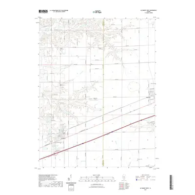
2021 Map of Altamont West
USGS Topo · Published 2021About this map
St Elmo and the western outskirts of Altamont anchor this southern Illinois landscape at the border of Fayette and Effingham counties. The map reveals a rural transition between structured agricultural grids and the winding drainage basins of Moccasin Cr and Sugar Cr. This modern survey documents a deep-rooted community fabric through numerous local burial grounds, including the Rhodes Family Cem and Crums Chapel Cem. The infrastructure of the region is defined by the east-west corridor of E Cumberland Rd and the presence of the Saint Elmo Old City Reservoir, which alongside Lake Timberline and Kuebler RLA Airport, marks the local industrial and recreational footprint. The dense network of county roads, such as Co RD 2400 N, illustrates the persistent township and range system that continues to organize this prairie terrain.
Find a feature on this map
65 named features on this map. Tap any name to fly to it.
Don’t see what you’re looking for? This feature index may not catch every label — zoom into the map to look around manually.
Map Details
Editions of this 2021 Altamont West Map
This is the sole edition of this map. No revisions or reprints were ever made.
Other maps of this area

1941 · St. Elmo
USGS Topo · 1:62,500

1945 · St. Elmo
USGS Topo · 1:62,500

1945 · Kinmundy
USGS Topo · 1:62,500

1947 · Kinmundy
USGS Topo · 1:62,500

1950 · Effingham
USGS Topo · 1:62,500

1951 · Effingham
USGS Topo · 1:62,500

1956 · Edgewood
USGS Topo · 1:62,500

1958 · Decatur
USGS Topo · 1:250,000

1958 · Belleville
USGS Topo · 1:250,000

1961 · Decatur
USGS Topo · 1:250,000