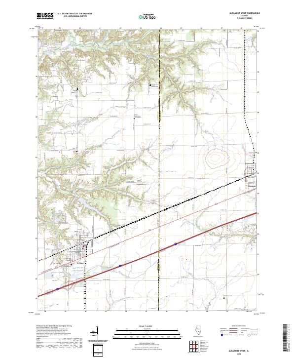
2024 Map of Altamont West
USGS Topo · Published 2024About this map
St. Elmo sits at the southwestern edge of this landscape where the Fayette and Effingham county lines meet. The terrain is defined by a dense network of watercourses, including Wolf Creek, Moccasin Creek, and Little Creek, which carve through the prairie lands of south-central Illinois. In the vicinity of St. Elmo, the Saint Elmo Old City Reservoir and Lake Timberline provide significant water features amidst the agricultural grid.
Find a feature on this map
67 named features on this map. Tap any name to fly to it.
Don’t see what you’re looking for? This feature index may not catch every label — zoom into the map to look around manually.
Map Details
Editions of this 2024 Altamont West Map
This is the sole edition of this map. No revisions or reprints were ever made.
Other maps of this area

1941 · St. Elmo
USGS Topo · 1:62,500

1945 · St. Elmo
USGS Topo · 1:62,500

1945 · Kinmundy
USGS Topo · 1:62,500

1947 · Kinmundy
USGS Topo · 1:62,500

1950 · Effingham
USGS Topo · 1:62,500

1951 · Effingham
USGS Topo · 1:62,500

1956 · Edgewood
USGS Topo · 1:62,500

1958 · Decatur
USGS Topo · 1:250,000

1958 · Belleville
USGS Topo · 1:250,000

1961 · Decatur
USGS Topo · 1:250,000