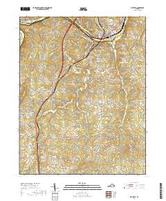
2019 Map of Altavista
USGS Topo · Published 2019About this map
The Roanoke River carves a path through the northern landscape of this Virginia Piedmont region, separating the industrial and residential hub of Altavista from the neighboring town of Hurt to the south. This 2019 survey documents a complex network of local roads and state routes, including the prominent US Route 29 corridor, that connects several smaller settlements such as Motley, Sycamore, and Hill Grove. The area's topography is defined by significant elevations like Brushy Mtn and Jasper Mtn, which overlook a dense drainage system comprising Sycamore Cr and the N Fork Stinking River. Genealogists and local historians can find several established burial sites, including Green Hill Cem and New Bethel Cem, reflecting the deep-rooted community history along the Campbell and Pittsylvania county line.
Find a feature on this map
115 named features on this map. Tap any name to fly to it.
Don’t see what you’re looking for? This feature index may not catch every label — zoom into the map to look around manually.
Map Details
Editions of this 2019 Altavista Map
This is the sole edition of this map. No revisions or reprints were ever made.
Other maps of this area

1892 · Lynchburg
USGS Topo · 1:125,000

1921 · Chatham
USGS Topo · 1:48,000

1923 · Chatham
USGS Topo · 1:62,500

1947 · Roanoke
USGS Topo · 1:250,000

1951 · Altavista
USGS Topo · 1:62,500

1953 · Greensboro
USGS Topo · 1:250,000

1954 · Greensboro
USGS Topo · 1:250,000

1954 · Riceville
USGS Topo · 1:62,500

1956 · Gladys
USGS Topo · 1:62,500

1959 · Roanoke
USGS Topo · 1:250,000