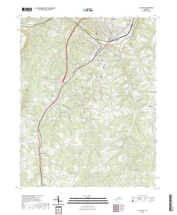
2022 Map of Altavista
USGS Topo · Published 2022About this map
The Roanoke River carves a winding path across the northern landscape, separating Altavista in Campbell County from the town of Hurt in Pittsylvania County. This 2022 survey illustrates a region defined by its waterway and historical transit corridors, where the river's bend dictates the local street grids of these primary settlements. To the south, the terrain becomes increasingly complex as it rises toward Jasper Mountain and Brushy Mountain, with the land drained by Sycamore Creek and the North Fork Stinking River. Rural communities like Motley, Hill Grove, and Sycamore are connected by a network of local roads such as Sanctuary Road and Izaak Walton Road. Genealogists and historians will find several burial grounds noted across the quadrangle, including Green Hill Cemetery near the river and New Bethel Cemetery to the east.
Find a feature on this map
124 named features on this map. Tap any name to fly to it.
Don’t see what you’re looking for? This feature index may not catch every label — zoom into the map to look around manually.
Map Details
Editions of this 2022 Altavista Map
This is the sole edition of this map. No revisions or reprints were ever made.
Other maps of this area

1892 · Lynchburg
USGS Topo · 1:125,000

1921 · Chatham
USGS Topo · 1:48,000

1923 · Chatham
USGS Topo · 1:62,500

1947 · Roanoke
USGS Topo · 1:250,000

1951 · Altavista
USGS Topo · 1:62,500

1953 · Greensboro
USGS Topo · 1:250,000

1954 · Greensboro
USGS Topo · 1:250,000

1954 · Riceville
USGS Topo · 1:62,500

1956 · Gladys
USGS Topo · 1:62,500

1959 · Roanoke
USGS Topo · 1:250,000