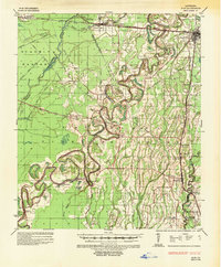
1935 Map of Alto
USGS Topo · Published 1952About this map
The Boeuf River snakes through the heart of this North Louisiana landscape, defining the transition between Richland Parish, Ouachita Parish, and Franklin Parish. During the mid-1930s, this region was a nexus of river-and-rail industry, featuring the Century Carbon Company and International Gas Products Company Inc along the Missouri Pacific Railroad. The map reveals a deeply intersected territory where the Yazoo and Mississippi Valley (Illinois Central) Railroad crosses Bayou Crew near Rayville. Notable for genealogists are the numerous scattered settlements and family-named landmarks, such as Rhymes Store and Ellwood Place, along with the Douciere Ferry on the western edge. The presence of the Magnolia Gas Line and United Gas Corporation facilities highlights the era's growing natural gas infrastructure amid the traditional plantation and small-town economy.
Find a feature on this map
54 named features on this map. Tap any name to fly to it.
Don’t see what you’re looking for? This feature index may not catch every label — zoom into the map to look around manually.
Map Details
Editions of this 1935 Alto Map
2 editions found
Other maps of this area

1935 · Collinston
USGS Topo · 1:62,500

1935 · Winnsboro
USGS Topo · 1:62,500

1935 · Alto
USGS Topo · 1:62,500

1935 · Baskinton
USGS Topo · 1:62,500

1935 · Hurricane
USGS Topo · 1:62,500

1935 · Drew
USGS Topo · 1:62,500

1939 · Fort Necessity
USGS Topo · 1:62,500

1940 · Monroe
USGS Topo · 1:62,500

1940 · Columbia
USGS Topo · 1:62,500

1955 · Jackson
USGS Topo · 1:250,000