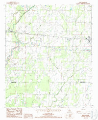
1987 Map of Dunn
USGS Topo · Published 1987About this map
Big Creek and its many meandering tributaries, including Wildcat Slough and Ash Slough, define the low-lying landscape of the Richland Parish and Franklin Parish border. In the late 1980s, the local economy appears rooted in petroleum extraction, evidenced by the extensive Oil Field operations scattered across the central and southern portions of the sheet. Small communities and rail-side locales like Dunn, Sacksonia, and Sun Spur line the corridor running toward Delhi.
Find a feature on this map
21 named features on this map. Tap any name to fly to it.
Don’t see what you’re looking for? This feature index may not catch every label — zoom into the map to look around manually.
Map Details
Editions of this 1987 Dunn Map
This is the sole edition of this map. No revisions or reprints were ever made.
Other maps of this area

1935 · Baskinton
USGS Topo · 1:62,500

1935 · Hurricane
USGS Topo · 1:62,500

1935 · Waverly
USGS Topo · 1:62,500

1955 · Jackson
USGS Topo · 1:250,000

1958 · Baskinton
USGS Topo · 1:62,500

1958 · Hurricane
USGS Topo · 1:62,500

1959 · Mitchiner
USGS Topo · 1:62,500

1961 · Jackson
USGS Topo · 1:250,000

1961 · Waverly
USGS Topo · 1:62,500

1962 · Jackson
USGS Topo · 1:250,000