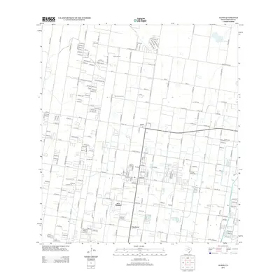
2012 Map of Alton
USGS Topo · Published 2012About this map
Alton and its neighboring communities in Hidalgo County reveal a landscape structured by a precise grid of mile roads and the underlying energy industry during the early 21st century. The map shows the significant footprint of petroleum extraction, with the Mission Gas Field, Sharyland Gas Field, and Oblate Gas Field distributed throughout the northern and western sections. Residential expansion is visible in the growing footprints of Palmhurst and West Sharyland, where subdivisions and smaller street networks began to fill the spaces between long-established agricultural corridors like W Monte Cristo Rd. The transportation network is anchored by a mix of historic routes, including Old Hwy 107, and modern thoroughfares like F-M 676, illustrating the transition from a purely rural economy to an increasingly suburbanized region of South Texas.
Find a feature on this map
37 named features on this map. Tap any name to fly to it.
Don’t see what you’re looking for? This feature index may not catch every label — zoom into the map to look around manually.
Map Details
Editions of this 2012 Alton Map
This is the sole edition of this map. No revisions or reprints were ever made.
Other maps of this area

1914 · San Juan
USGS Topo · 1:48,000

1916 · San Juan
USGS Topo · 1:62,500

1940 · Monte Christo
USGS Topo · 1:62,500

1949 · Mc Allen
USGS Topo · 1:250,000

1954 · McAllen
USGS Topo · 1:250,000

1957 · Mc Allen
USGS Topo · 1:250,000

1962 · McAllen
USGS Topo · 1:250,000

1963 · Monte Christo
USGS Topo · 1:24,000

1963 · La Joya
USGS Topo · 1:24,000

1963 · Edinburg
USGS Topo · 1:24,000