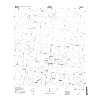
2016 Map of Alton
USGS Topo · Published 2016About this map
Alton and its surrounding colonias represent a complex landscape of residential growth in Hidalgo County during the mid-2010s. The map captures an intricate network of rural subdivisions and established communities, including Nuevo Alton Colonia, Rancho Chaparral Colonia, and Jardin Terrace Colonia. This settlement pattern illustrates the rapid suburbanization of the Rio Grande Valley, where former agricultural tracts have been partitioned into distinct neighborhoods. The road grid, defined by major routes like FM 681 and FM 1925, connects these clusters to the larger urban centers of Mission and McAllen. North of the dense developments, the landscape transitions into more regularized plots along Monte Cristo St, where smaller residential enclaves such as Buena Fe and Buena Vida begin to fill the gaps between citrus groves and fields.
Find a feature on this map
159 named features on this map. Tap any name to fly to it.
Don’t see what you’re looking for? This feature index may not catch every label — zoom into the map to look around manually.
Map Details
Editions of this 2016 Alton Map
This is the sole edition of this map. No revisions or reprints were ever made.
Other maps of this area

1914 · San Juan
USGS Topo · 1:48,000

1916 · San Juan
USGS Topo · 1:62,500

1940 · Monte Christo
USGS Topo · 1:62,500

1949 · Mc Allen
USGS Topo · 1:250,000

1954 · McAllen
USGS Topo · 1:250,000

1957 · Mc Allen
USGS Topo · 1:250,000

1962 · McAllen
USGS Topo · 1:250,000

1963 · Monte Christo
USGS Topo · 1:24,000

1963 · La Joya
USGS Topo · 1:24,000

1963 · Edinburg
USGS Topo · 1:24,000