2022 Map of Alton
USGS Topo · Published 2022About this map
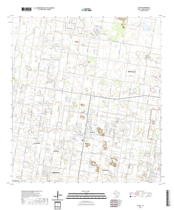
Alton sits at the heart of this Hidalgo County landscape, where the traditional agricultural grid of the Rio Grande Valley meets modern suburban expansion. The map details a dense network of residential corridors and thoroughfares, such as 7 Mile Line and W Monte Cristo Rd, which connect established communities like La Homa and Palmhurst with the growing edges of McAllen and Mission. This area is defined by its transition from open fields to academic and civic centers, including the Texas A and M University Higher Education Center at McAllen in the northeast. Small, significant historical markers remain visible amidst the development, most notably the Shary Memorial Chapel Cem, reflecting the deep-rooted heritage of West Sharyland. The intricate road system, including Old Hwy 107 and numerous numbered mile roads, illustrates the systematic organization of land and commerce that continues to shape this region.
Find a feature on this map
48 named features on this map. Tap any name to fly to it.
Don’t see what you’re looking for? This feature index may not catch every label — zoom into the map to look around manually.
Map Details
Editions of this 2022 Alton Map
This is the sole edition of this map. No revisions or reprints were ever made.