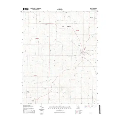
2015 Map of Alton
USGS Topo · Published 2015About this map
Alton serves as the primary hub in this Missouri landscape, situated at the junction of Highway 160 and Route 19. The map reveals a high density of named hollows and springs, reflecting the complex karst topography of Oregon County. Notable family and historical markers include the Huddleston Graveyard near Huddleston and the Smyrna Cemetery, which anchor the area's genealogical history. The drainage network is particularly detailed, tracing Frederick Cr and Piney Cr as they weave through terrain marked by features like Graham Hollow and Cave Hollow. Rural settlements such as Royal Oak and Woodside dot the northern reaches, connected by a web of county roads that have long defined the movement of people and livestock through the Ozarks. The inclusion of several natural springs, such as Simpson Spring and Norman Spring, highlights the critical water sources that determined early farmstead and community locations in this region.
Find a feature on this map
85 named features on this map. Tap any name to fly to it.
Don’t see what you’re looking for? This feature index may not catch every label — zoom into the map to look around manually.
Map Details
Editions of this 2015 Alton Map
This is the sole edition of this map. No revisions or reprints were ever made.
Other maps of this area

1931 · Bandyville
USGS Topo · 1:48,000

1943 · Thayer
USGS Topo · 1:62,500

1944 · Couch
USGS Topo · 1:62,500

1944 · Birch Tree
USGS Topo · 1:62,500

1945 · Montier
USGS Topo · 1:62,500

1946 · Thayer
USGS Topo · 1:62,500

1946 · Couch
USGS Topo · 1:62,500

1948 · Montier
USGS Topo · 1:62,500

1948 · Birch Tree
USGS Topo · 1:62,500

1957 · Poplar Bluff
USGS Topo · 1:250,000